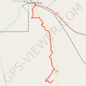
Adelaide River - Robin Falls
#Hike
- Distance: 12.0 mi
- Elevation gain: 1,217 ft
- Maximum elevation: 705 ft
- Elevation loss: 1,135 ft
- Minimum elevation: 151 ft
Interactive map
GPS track profile
About this GPS track
Name: Adelaide River - Robin Falls GPS track, route, trail
End: Robin Falls Road, Robin Falls, Coomalie Shire, Northern Territory, Australia (-13.35080 131.13534)
Coordinates: -13.35462 131.10281 -13.23927 131.13694