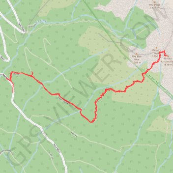
Mount Arrowsmith Judge's route
#Hike
- Distance: 4.9 mi
- Elevation gain: 3,609 ft
- Maximum elevation: 5,902 ft
- Elevation loss: 3,622 ft
- Minimum elevation: 2,461 ft
Interactive map
GPS track profile
About this GPS track
Name: Mount Arrowsmith Judge's route GPS track, route, trail
Coordinates: 49.21646 -124.62129 49.22432 -124.59467
Other GPS tracks
Click on a GPS track to view route, its statistics and profile.
Sproat Lake - Nanaimo
Canada > British Columbia > Alberni-Clayoquot Regional District > Area D (Sproat Lake)
Distance: 54.0 mi • Elevation gain: 4,177 ft • Maximum elevation: 1,385 ft