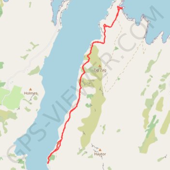
Pigeon Bay Walkway - Whitehead Bay
#Hike
- Distance: 9.8 mi
- Elevation gain: 1,604 ft
- Maximum elevation: 472 ft
- Elevation loss: 1,594 ft
- Minimum elevation: 3 ft
Interactive map
GPS track profile
About this GPS track
Name: Pigeon Bay Walkway - Whitehead Bay GPS track, route, trail
Coordinates: -43.67858 172.90074 -43.62611 172.93525
Other GPS tracks
Click on a GPS track to view route, its statistics and profile.