Ballyroon Mountain - Sheep's Head
Interactive map
GPS track profile
About this GPS track
Name: Ballyroon Mountain - Sheep's Head GPS track, route, trail
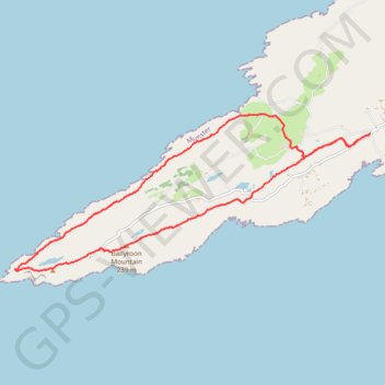
Start: Sheepshead, West Cork, County Cork, Munster, Ireland (51.56386 -9.75860)
End: Sheepshead, West Cork, County Cork, Munster, Ireland (51.56390 -9.75845)
Coordinates: 51.54250 -9.84770 51.56698 -9.75845
Other GPS tracks
Click on a GPS track to view route, its statistics and profile.
Trace IRELAND
Distance: 936.2 mi • Elevation gain: 43,829 ft • Maximum elevation: 1,719 ft
RT5-1 Rosslare - Kinsale
Distance: 1,777.3 mi • Elevation gain: 89,833 ft • Maximum elevation: 1,378 ft
RT5-1 Rosslare - Kinsale
Distance: 2,402.9 mi • Elevation gain: 118,488 ft • Maximum elevation: 1,719 ft
RT5-1 Rosslare - Kinsale
Distance: 841.0 mi • Elevation gain: 50,016 ft • Maximum elevation: 1,378 ft
39: Dunmanus – Ballydehob (Developed with signs)
Distance: 30.2 mi • Elevation gain: 2,310 ft • Maximum elevation: 518 ft