Cobble Hill Loop
Cobble Hill Mountain Regional Recreation Area. #Hike #MTB #Loop #CobbleHill
- Distance: 4.5 mi
- Elevation gain: 1,066 ft
- Maximum elevation: 1,050 ft
- Elevation loss: 1,066 ft
- Minimum elevation: 344 ft
Interactive map
GPS track profile
About this GPS track
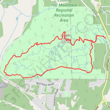
Name: Cobble Hill Loop GPS track, route, trail
Coordinates: 48.67943 -123.63624 48.68869 -123.60538
Other GPS tracks
Click on a GPS track to view route, its statistics and profile.
Cobble Hill Mountain Regional Recreation Area
Canada > British Columbia > Cowichan Valley Regional District > Area C (Cobble Hill) > Cobble Hill
#Hike #Loop #CobbleHill
Distance: 2.2 mi • Elevation gain: 732 ft • Maximum elevation: 1,030 ft