Elbow, Sugar Daddy, Strange Brew, Bobcat and Fullerton Loop
Kananaskis Country Public Land Use Zone. Elbow River. #Hike #Run #Loop #Kananaskis
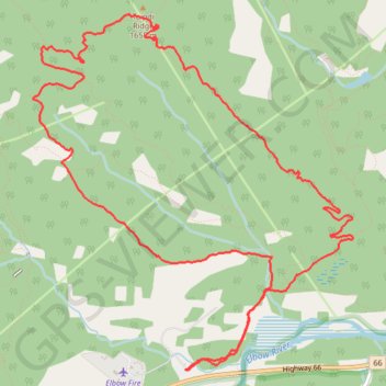
- Distance: 7.5 mi
- Elevation gain: 1,234 ft
- Maximum elevation: 5,623 ft
- Elevation loss: 1,234 ft
- Minimum elevation: 4,570 ft
Interactive map
GPS track profile
About this GPS track
Name: Elbow, Sugar Daddy, Strange Brew, Bobcat and Fullerton Loop GPS track, route, trail
Start: Fullerton Trailhead, Elbow Trail, Division No. 15, Alberta, Canada (50.90232 -114.69010)
End: Fullerton Trailhead, Elbow Trail, Division No. 15, Alberta, Canada (50.90232 -114.69010)
Coordinates: 50.90223 -114.70685 50.92686 -114.67177