Barranco del Infierno
Par Adeje. #Randonnée
- Distance: 1.8 mi
- Elevation gain: 1,781 ft
- Maximum elevation: 2,513 ft
- Elevation loss: 423 ft
- Minimum elevation: 1,135 ft
Interactive map
GPS track profile
About this GPS track
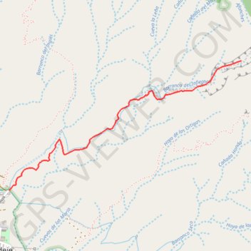
Name: Barranco del Infierno GPS track, route, trail
Coordinates: 28.12635 -16.72359 28.13603 -16.70387