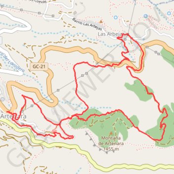
Artenara - Arbejas
- Distance: 4.1 mi
- Elevation gain: 1,165 ft
- Maximum elevation: 4,760 ft
- Elevation loss: 1,165 ft
- Minimum elevation: 4,016 ft
Interactive map
GPS track profile
About this GPS track
Name: Artenara - Arbejas GPS track, route, trail
Start: Calle Camino de La Cilla, Artenara, Las Palmas, Îles Canaries, 35350, Espagne (28.02036 -15.64719)
End: Calle Camino de La Cilla, Artenara, Las Palmas, Îles Canaries, 35350, Espagne (28.02036 -15.64719)
Coordinates: 28.01801 -15.64719 28.02680 -15.63213
Other GPS tracks
Click on a GPS track to view route, its statistics and profile.
TGCC 2024 10.07.2023
Espagne > Las Palmas de Grande Canarie
Distance: 79.6 mi • Elevation gain: 23,612 ft • Maximum elevation: 5,728 ft