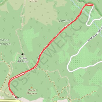
2018-05-13 10:48:26
En aller-retour.
- Distance: 2.4 mi
- Elevation gain: 531 ft
- Maximum elevation: 4,882 ft
- Elevation loss: 535 ft
- Minimum elevation: 4,501 ft
- Moving time: 49 m 36 s
- Moving speed: 3.0 mph
- Maximum speed: 5.1 mph
- Total time: 53 m 57 s
- Global speed: 2.7 mph
- Date: 05/13/2018
Interactive map
GPS track profile
About this GPS track
Name: 2018-05-13 10:48:26 GPS track, route, trail
Coordinates: 37.69927 15.05259 37.71138 15.06631
Other GPS tracks
Click on a GPS track to view route, its statistics and profile.
Terdav - Eoliennes - J7 - Transfert de l'Etna à Catane
Italie > Sicile > Catane > Linguaglossa
Randonnée pédestre. En aller simple. #Randonnée
Distance: 41.3 mi • Elevation gain: 1,660 ft • Maximum elevation: 5,883 ft