Rando Mont-Rebei
Interactive map
GPS track profile
About this GPS track
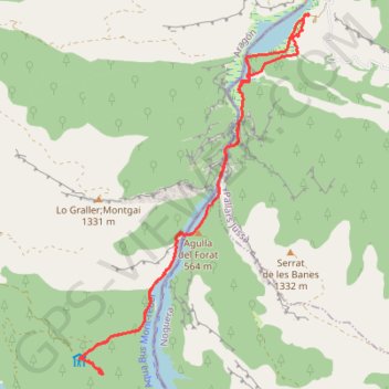
Name: Rando Mont-Rebei GPS track, route, trail
Start: P 1, (camí inundable), Sant Esteve de la Sarga, Pallars-Inférieur, 25632, Espagne (42.09730 0.69609)
Coordinates: 42.05020 0.65556 42.09753 0.69628
Other GPS tracks
Click on a GPS track to view route, its statistics and profile.
Southern section — European Divide Trail
France > Auvergne-Rhône-Alpes > Drôme > Valence
Distance: 1,506.1 mi • Elevation gain: 139,026 ft • Maximum elevation: 6,578 ft
1 LUCENA - MONTPELLIER
Espagne > Andalousie > Lucena
Distance: 1,842.0 mi • Elevation gain: 96,785 ft • Maximum elevation: 3,438 ft
1 LUCENA - MONTPELLIER
Distance: 1,842.0 mi • Elevation gain: 96,785 ft • Maximum elevation: 3,438 ft
Stage 26: Valence to Saint-Jean-de-Fos — European Divide Trail
France > Auvergne-Rhône-Alpes > Drôme > Valence
Distance: 1,506.1 mi • Elevation gain: 139,026 ft • Maximum elevation: 6,578 ft
Bardenas_Andorre_Mediterranee
Bardenas_Andorre_Mediterranee
Distance: 628.2 mi • Elevation gain: 80,394 ft • Maximum elevation: 7,264 ft
Stage 26: Valence to Saint-Jean-de-Fos — European Divide Trail
France > Auvergne-Rhône-Alpes > Drôme > Valence
Distance: 1,012.7 mi • Elevation gain: 101,184 ft • Maximum elevation: 6,578 ft
De Villeneuve-sur-Lot à Guimarães
France > Nouvelle-Aquitaine > Lot-et-Garonne > Villeneuve-sur-Lot
Distance: 1,257.8 mi • Elevation gain: 72,575 ft • Maximum elevation: 4,393 ft