Gatteville le Phare (50760)
Interactive map
GPS track profile
About this GPS track
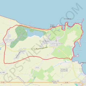
Name: Gatteville le Phare (50760) GPS track, route, trail
Coordinates: 49.67832 -1.31719 49.69553 -1.26588
Other GPS tracks
Click on a GPS track to view route, its statistics and profile.
French Divide
France > Hauts-de-France > Nord > Bray-Dunes
Traversez la France du nord au sud sur 2200 Km de sentiers, chemins et petites routes... Magique ! Vous connaissez la mythique Great Divide ? La French Divide est elle aussi en train de devenir une grande classique des traversées en bikepacking et sans assistance !
Distance: 1,376.9 mi • Elevation gain: 110,164 ft • Maximum elevation: 4,754 ft
Tour d'Europe
France > Bretagne > Finistère > Concarneau > Landan Creis
Distance: 4,432.2 mi • Elevation gain: 146,335 ft • Maximum elevation: 7,982 ft
GR 223 Tour du Cotentin (2021)
France > Normandie > Eure > Berville-sur-Mer
Randonnée en Normandie sur le GR 223 autour du Cotentin à travers l'Eure, le Calvados et la Manche de Berville-sur-Mer au Mont-Saint-Michel.
Distance: 404.3 mi • Elevation gain: 21,932 ft • Maximum elevation: 489 ft
GR 223 : De Carentan à Cherbourg (Manche)
France > Normandie > Manche > Carentan-les-Marais
Randonnée en Normandie sur le GR 223, Le sentier du littoral, à travers la Manche de Carentan à Cherbourg via Brucheville, Sainte-Mère-Église, Tatihou (Saint-Vaast-la-Hougue), Saint-Vaast-la-Hougue et Saint-Pierre-Église. #Randonnée #GR223 #Mer #Campagne #Manche #Normandie #Cotentin #Nature
Distance: 79.9 mi • Elevation gain: 2,277 ft • Maximum elevation: 489 ft
RAF 2022 / 2600 n1 News
France > Hauts-de-France > Pas-de-Calais > Le Touquet-Paris-Plage
Distance: 1,612.3 mi • Elevation gain: 130,331 ft • Maximum elevation: 9,075 ft
Etape 1 - BARFLEUR à GATTEVILLE-PHARE
France > Normandie > Manche > Gatteville-le-Phare
Distance: 2.6 mi • Elevation gain: 69 ft • Maximum elevation: 43 ft
Treport Mont saint Michel
France > Normandie > Seine-Maritime > Le Tréport
Vélo. En aller simple entre Le Tréport et Pontorson. #Vélo
Distance: 229.9 mi • Elevation gain: 11,132 ft • Maximum elevation: 938 ft
Itinéraire de Nemours à Nemours
France > Centre-Val de Loire > Loiret > Bromeilles > Bainvilliers
Distance: 979.5 mi • Elevation gain: 28,005 ft • Maximum elevation: 781 ft
1902_cm1367eg2_201907_EV3_complet
France > Hauts-de-France > Nord > Jeumont
ECF
Distance: 1,075.1 mi • Elevation gain: 34,688 ft • Maximum elevation: 915 ft
1 - 2024_semi_marathon_des_vikings_-13108350-1650515667-119
France > Normandie > Manche > Gatteville-le-Phare
semi-marathon des Vikings 2024
Distance: 13.1 mi • Elevation gain: 217 ft • Maximum elevation: 56 ft
Track-Saint Jean de Luz
Belgique > Hainaut > Ath > Lessines
Distance: 740.9 mi • Elevation gain: 31,145 ft • Maximum elevation: 1,594 ft
Track-Saint de Luz retour
France > Nouvelle-Aquitaine > Pyrénées-Atlantiques > Saint-Jean-de-Luz
Distance: 704.3 mi • Elevation gain: 22,598 ft • Maximum elevation: 843 ft
Lc100b-2022
France > Normandie > Manche > Bretteville > Hameau des Cordeliers
Distance: 64.1 mi • Elevation gain: 5,466 ft • Maximum elevation: 512 ft
Tous les coins du Cotentin-12150732
France > Normandie > Manche > Saint-Floxel
Distance: 197.5 mi • Elevation gain: 10,512 ft • Maximum elevation: 551 ft
La_connerie_100_bornes
France > Normandie > Manche > Bretteville > Le Grand Heu
Distance: 63.6 mi • Elevation gain: 6,161 ft • Maximum elevation: 577 ft
RdA 2022 E3
France > Normandie > Manche > Le Havre de Quinéville > Les Roques
Distance: 64.3 mi • Elevation gain: 4,104 ft • Maximum elevation: 545 ft
G2-G3 Dimanche D6
France > Normandie > Manche > Anneville-en-Saire
Distance: 42.1 mi • Elevation gain: 1,768 ft • Maximum elevation: 364 ft
20220602Marche en extérieur
France > Normandie > Manche > Vicq-sur-Mer > Néville-sur-Mer > Village d'Austhot
Distance: 4.5 mi • Elevation gain: 112 ft • Maximum elevation: 72 ft
Voyage vélo Catalina Guido
France > Normandie > Seine-Maritime > Dieppe
Vélo. En aller simple entre Dieppe et Le Mont-Saint-Michel. #Vélo
Distance: 282.2 mi • Elevation gain: 15,810 ft • Maximum elevation: 1,001 ft